


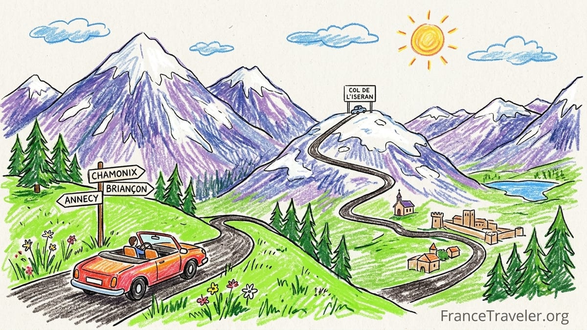
The French Alps are made for drivers. Between Annecy’s lakeside promenades and Briançon’s stone fortifications lies a string of high passes, glaciated peaks and quiet valleys that reward those willing to take the long, scenic way around. This guide builds a practical, road focused itinerary from north to south, using Annecy, Chamonix, Beaufortain, Val d’Isère, the Col de l’Iseran, Vanoise and the Écrins region, with optional Route des Grandes Alpes segments and up to date 2026 information on seasons, passes, parking, tolls and driving times.
How to Structure a North to South French Alps Road Trip
A logical way to cross the French Alps by car in 2026 is to start in Annecy and finish in Briançon, threading together short driving days and high road passes. A typical itinerary might run Annecy – Chamonix – Beaufortain – Val d’Isère – Col de l’Iseran and Haute Maurienne – Briançon and the Écrins. This keeps daily driving between 2 and 4 hours, leaving time for stops, cable cars and short walks at altitude rather than back to back transfers on motorways.
Many travelers arrive via Geneva Airport and pick up a rental car there before driving 45 minutes to Annecy or 1 hour 15 minutes to Chamonix on the A40. Starting in Annecy lets you ease into alpine driving: the first day’s roads run along the lakeshore or through gentle foothills rather than immediately launching into steep hairpins. From Briançon at the southern end you can continue to the Provence valleys or the Riviera, or loop back via Grenoble to Lyon’s TGV hub.
This route overlaps parts of the classic Route des Grandes Alpes, the century old tourist itinerary linking Lake Geneva and the Mediterranean via a chain of high passes. On this north to south trip, you will intersect it around Col des Aravis, the Tarentaise valley and Col de l’Iseran. You can either stay on the official Route des Grandes Alpes for several stages or dip in and out where the scenery is strongest without committing to the full multi day traverse.
Because opening dates for the highest passes vary every year, road trippers should think of this as a flexible framework. In a heavy snow year Col de l’Iseran or Galibier might not open until late June, while in a dry spring you could drive them by early June. Booking fully flexible hotel rates in the higher villages such as Val d’Isère or Bonneval sur Arc lets you adjust by a night or two if a late storm delays snow clearing.
Seasonality and Pass Openings in 2026
For 2026, the highest Alpine passes in Savoie and Hautes Alpes broadly follow their usual pattern: most cols above 2,000 meters reopen sometime between late May and mid June and close again with the first sustained snowfalls in late October or early November. Department road services in Savoie noted that Col de l’Iseran is traditionally the last to be fully cleared, with work typically starting at the end of May and the road reopening around mid June. Local bulletins for 2026 confirm a planned reopening around 12 June, with a provisional winter closure scheduled for early November.
In practice this means that if you want the full high pass experience at Col de l’Iseran and Galibier, the safest window is from the last week of June through mid September. Shoulder periods in early June and late September can be magical for light traffic and golden larch forests, but you need to watch short term weather forecasts and official road advisories. It is not unusual for an early autumn storm to close Galibier or Iseran for a few days at the end of September even if they reopen afterwards.
Lower passes such as Col des Aravis and Col du Lautaret, which links Grenoble and Briançon at just over 2,050 meters, tend to open earlier and stay open longer. The Lautaret is an important regional artery and is typically maintained from late May until late autumn, with occasional short closures during heavy snow or avalanche control. If you travel in May or very early June when higher cols are still snowbound, it is often possible to reach Briançon via Lautaret while detouring around Iseran or Galibier on valley roads.
The key for 2026 is to plan for flexibility. Build in one or two “buffer” days that can be used either for extra hiking or for a lower level driving alternative if a high route closes temporarily. Before leaving each village, check the local tourist office boards or departmental road websites for live pass status rather than relying on printed maps that only show typical seasons.
Annecy to Chamonix: Lakeside Ease to High Peaks
The drive from Annecy to Chamonix is a gentle introduction before you reach the more complex passes further south. By the A41 and A40 motorway, the distance is roughly 100 kilometers and takes about 1 hour 30 minutes in normal traffic. This tolled route is the most practical if you are collecting a rental car in Annecy late in the day and want to reach Chamonix before dark. Expect to pay a modest toll at the Autoroute Blanche barriers east of Bonneville, usually under 10 euros for a standard car, with payment accepted by card or cash.
If time allows, a slower D road option via the Aravis foothills is much more scenic and links in neatly with the Route des Grandes Alpes. From Annecy you can drive along the lake’s eastern shore toward Talloires, then climb through Thônes to Col des Aravis, with expansive views of Mont Blanc. From there you descend to La Clusaz and Saint Jean de Sixt before rejoining the main N205 / A40 approach to Chamonix. This detour almost doubles the travel time to around 3 hours with stops, but the road surface is good and the gradients are manageable for drivers new to mountain roads.
You can comfortably spend two nights in Annecy as a lakeside base, using paid underground car parks such as Hôtel de Ville or Bonlieu where day rates are typically around 20 to 30 euros, then two or three nights in Chamonix to explore the Mont Blanc massif. Chamonix itself has numerous signed surface lots near the Aiguille du Midi cable car and around the train station. Parking charges vary, but you can usually budget about 1.50 to 2.50 euros per hour in high season, with some hotels and apartment rentals offering private garages for an overnight fee.
Fuel and services are straightforward on this stretch. Large supermarkets on the outskirts of Annecy and Sallanches have the cheapest petrol and diesel, with self service pumps often several cents per litre cheaper than motorway service areas. If your rental car is petrol, consider topping up at one of these before climbing into Chamonix, where smaller station forecourts sometimes carry a premium. Public fast charging for electric cars is also improving along the A40 corridor, though availability in high valleys can still be patchy.
Chamonix to Beaufortain: Into the Heart of the Mountains
From Chamonix, rather than dropping straight into the crowded Tarentaise valley, a rewarding route is to loop via the Beaufortain, a quieter massif of pastures, dams and small villages renowned for their cheese. One practical option is to drive from Chamonix back toward Sallanches, then south via Megève and the Val d’Arly. This route uses a mix of national and departmental roads, with driving time around 2 hours to reach the Beaufort valley near Beaufort or Arêches, not counting stops in villages such as Flumet or Ugine.
The roads here are twisting but not technically difficult, with regular villages where you can pull over for coffee or a bakery stop. The Beaufortain makes an excellent one or two night base because it breaks up what might otherwise be a long transfer day to Val d’Isère. In summer 2026 many family run hotels and chalets in Arêches, Hauteluce and around Lac de Roselend operate on flexible half board plans, which is convenient if you prefer to leave the car parked after your day’s drive and walk to dinner.
For driving enthusiasts, the loop over Cormet de Roselend, if open, is one of the region’s most scenic diversions. The pass itself, at just under 2,000 meters, usually opens sometime in late May or early June, slightly earlier than the highest cols. From Beaufort you climb past the turquoise reservoir of Lac de Roselend, crest the pass and then descend toward Bourg Saint Maurice in the upper Tarentaise. Allow at least 2 hours for the Beaufort to Bourg Saint Maurice section, with additional time for photo stops and short walks near the dam.
Parking and services in the Beaufortain are modest but sufficient. Village centers typically have small free public lots signed as “Parking” where you can leave your car to visit markets or walk to viewpoints. Fuel is more limited, so it is wise to arrive with at least half a tank from larger valley towns like Albertville or Sallanches. In some hamlets, mobile data can be slow or intermittent, so download offline maps before you enter the smaller valleys.
Val d’Isère, Col de l’Iseran and the Vanoise High Roads
From Beaufortain, the road drops into Bourg Saint Maurice, gateway to the Haute Tarentaise. From here, the climb to Val d’Isère via the D902 is classic Route des Grandes Alpes territory. The distance from Bourg Saint Maurice to Val d’Isère is roughly 30 kilometers, but the combination of tunnels, avalanche galleries and hairpins means you should allow at least 45 minutes to 1 hour of driving. In high summer the road sees steady traffic from cyclists, motorbikes, campervans and supply trucks, so build in extra time and expect slower vehicles.
Val d’Isère makes a practical overnight or two night base at about 1,850 meters. In summer, much of the village’s underground parking used in ski season remains available, often at reduced rates compared with winter. Some structures operate on a day maximum price, which can be a good deal if you want to leave the car while you hike in the Vanoise National Park or take the roads higher. As elsewhere in the Alps, you will pay less for fuel in Bourg Saint Maurice or in Albertville than in Val itself, so it pays to refuel in the valley before climbing.
The Col de l’Iseran, just above Val d’Isère, is the highest paved pass in the Alps at 2,770 meters and one of the most iconic sections of the Route des Grandes Alpes. In 2026, local authorities in Savoie and Haute Maurienne expect the pass to open around mid June after snow clearing that typically begins in late May and to remain open until early November, weather permitting. Even at the height of summer you can encounter patches of snow beside the road and rapid changes in weather, so carry a warm layer and check temperatures at altitude; it is often 10 to 15 degrees Celsius cooler at the summit than down in Annecy or Grenoble.
From Val d’Isère to Bonneval sur Arc on the southern side of the Iseran, the drive is under 40 kilometers but requires a full hour or more with frequent stops for views. Many travelers choose to overnight in the Haute Maurienne in villages such as Bonneval or Bessans to experience a quieter end of the valley before continuing south. Roadside parking areas and small pullouts around the pass are popular for photo stops, but you must avoid blocking passing places; gendarmes occasionally ticket poorly parked vehicles on busy weekends in July and August.
Through Haute Maurienne to Briançon and the Écrins
From Haute Maurienne, there are two main ways to continue south by car: either you stay within France and arc around through the Maurienne and Oisans via Galibier and Lautaret, or you briefly cross into Italy via Mont Cenis and then loop back toward Briançon through the Susa valley. Both options include high passes with seasonal closures, so the exact routing depends on whether you are traveling in early summer, peak August or late autumn.
The classic Route des Grandes Alpes variant runs from the Maurienne valley over Col du Télégraphe to Valloire, then up to Col du Galibier at over 2,600 meters and down to Col du Lautaret, finally following the D1091 east into Briançon. When open, this is one of the great driving days in Europe, but it is also busy in high season and involves sustained climbs and descents. In a typical year, Galibier opens in early to mid June and closes around late October, but short term weather can cause brief closures, especially in September.
If Galibier is closed or you want a gentler profile, you can drive from Haute Maurienne to Modane, take the valley roads west toward Saint Jean de Maurienne and then south via Grenoble before following the D1091 over Col du Lautaret into Briançon. This adds distance but keeps you on lower roads that are maintained longer in shoulder seasons. The Lautaret itself, at about 2,057 meters, is an all summer pass with a long history as a key link between Grenoble and Briançon, and it is usually passable between late May and late autumn, subject to winter weather and occasional works.
On arrival in Briançon, you find a compact fortified town with a mix of underground and open air parking around the old Vauban citadel and the modern lower town. Many hotels along the main approach roads offer private parking, sometimes free, sometimes for a modest nightly fee. Briançon is the gateway to the Écrins National Park, and within 30 to 60 minutes’ drive you can reach valleys such as the Guisane toward Monêtier les Bains, the Vallouise toward Ailefroide and the Durance gorge near L’Argentière la Bessée. These side trips make for rewarding half or full days using Briançon as a base for three or four nights.
Driving Practicalities: Tolls, Fuel, Parking and Timing
Planning a French Alps road trip in 2026 requires attention to a few practical details that can make the difference between a smooth journey and a stressful one. On this north to south itinerary, toll motorways are mainly concentrated around the approach from Geneva and Lyon to Annecy, Chamonix and Albertville. Once you are in the high valleys and on the Route des Grandes Alpes segments, most of the scenic driving is on untolled departmental roads. Keeping some euro coins and a bank card handy for toll booths avoids delays, though most newer lanes accept contactless payments.
Fuel prices in mountain resorts are typically higher than in valley towns and big box supermarkets. It is sensible to fill up in places like Annecy, Sallanches, Albertville, Bourg Saint Maurice or Modane rather than in small stations at Val d’Isère, La Clusaz or tiny Maurienne villages. As a rough guide, a full tank for a compact rental car might cost between 70 and 100 euros depending on fuel type and prices at the time of travel. Distances between fuel stations on the main valleys are not huge, but once you are on a high pass road such as Iseran or Galibier there are no services at the summit, so never start an ascent with less than a quarter tank.
Parking in alpine towns is a mixture of paid underground garages, short stay curbside bays and free or low cost surface lots on the outskirts. Annecy and Chamonix have well signed parking systems with digital boards showing available spaces, while smaller villages display simple roadside signs pointing to “Parking” or “P”. In busy weeks such as late July and early August, underground car parks in Chamonix or Annecy can fill by mid morning; arriving early or choosing accommodation with a reserved space can save time circling for a spot.
Daily driving times on this itinerary are intentionally modest to allow flexibility. Typical legs are Annecy to Chamonix in 1.5 to 3 hours depending on route, Chamonix to Beaufortain in about 2 hours, Beaufortain to Val d’Isère via Cormet de Roselend and Bourg Saint Maurice in around 3 hours with stops, and Val d’Isère to Briançon via Iseran, Maurienne and Galibier or Lautaret in 4 to 5 hours. Weather, roadworks or summer holiday traffic can add delays, so it is unwise to stack a long mountain drive and a fixed time reservation such as a non refundable cable car booking on the same morning.
When Scenic Detours Are Worth the Extra Time
Not every mountain road justifies an extra hour behind the wheel, but a few detours on this route are genuinely worth building into your schedule. Col des Aravis between Annecy and Chamonix provides one of the most photogenic framed views of Mont Blanc, with viewpoints near the chapel at the pass. Even if it adds an hour compared with the A40, many drivers consider it a highlight of their trip, especially early or late in the day when traffic is light and the pastures are quiet.
Cormet de Roselend is similarly rewarding. The combination of the reservoir’s turquoise water, the grassy shorelines and the backdrop of higher rock peaks makes it a favorite among photographers and cyclists. Taking picnic supplies from Beaufort or a supermarket in Albertville and stopping at one of the informal parking bays around the lake turns this into a relaxed lunch stop en route to the Tarentaise. On a clear day, the reflections on the lake surface and the passing of clouds create constantly changing light that justifies the detour.
Further south, the pair of Telegraphe and Galibier offers a more rugged, high mountain character, with open scree slopes, distant views of the Écrins and a sense of exposure. For confident drivers comfortable with steep gradients and narrow sections, it is a classic Route des Grandes Alpes experience. If you are less keen on steep drop offs or are traveling with passengers who prefer gentler roads, Col du Lautaret remains scenic yet less intimidating, with wider bends and more gradual climbs.
Ultimately, the value of each detour depends on your priorities and the overall length of your trip. On a tight one week schedule from Geneva, you may choose to prioritize Iseran and a single high day around Galibier or Lautaret. With ten days or more, you can comfortably include Aravis, Roselend, Iseran and both Galibier and Lautaret, using intermediate bases like Beaufortain and Haute Maurienne to keep individual driving days pleasant rather than punishing.
The Takeaway
A French Alps road trip from Annecy to Briançon in 2026 rewards careful planning and a willingness to trade speed for scenery. By structuring your journey as a sequence of short driving days and choosing overnight bases like Annecy, Chamonix, Beaufortain, Val d’Isère, Haute Maurienne and Briançon, you unlock some of Europe’s finest high roads without exhausting yourself or your passengers.
Staying flexible around high pass openings, monitoring local road information and building in buffer days helps you adapt to the capricious alpine weather. In return, you gain access to legendary climbs like Col de l’Iseran and Galibier, quieter gems such as Cormet de Roselend and the pastoral Beaufortain, and the rugged valleys of the Écrins, all stitched together by well maintained French departmental roads.
Above all, this is a journey best enjoyed at a relaxed pace. Allow time to linger at lookouts, stop for roadside picnics and swap the driver’s seat for a short hike or a cable car ride when you reach each base. With that approach, the drive itself becomes the core of the trip rather than just the way you get from one resort to the next.
FAQ
Q1. When is the best time in 2026 to drive Col de l’Iseran and other high passes?
The most reliable window is from late June to mid September, when Col de l’Iseran, Galibier and Cormet de Roselend are typically open and snow free, though exact opening and closing dates depend on weather.
Q2. How many days should I plan for a road trip from Annecy to Briançon?
A comfortable minimum is 7 days, with 2 nights in Annecy, 2 in Chamonix or Beaufortain, 2 around Val d’Isère or Haute Maurienne and 1 to 2 nights in Briançon and the Écrins region.
Q3. Do I need a special type of car for this French Alps itinerary?
No special vehicle is required in summer; a standard compact or midsize car with good brakes is sufficient. In early or late season, you may need to carry chains or use winter rated tyres if snow is forecast.
Q4. Are the French motorways and mountain passes on this route tolled?
The approach motorways such as the A40 and A41 have tolls, but most of the scenic high passes, including Aravis, Roselend, Iseran, Galibier and Lautaret, are toll free departmental roads.
Q5. Is parking difficult in Annecy, Chamonix and Val d’Isère in summer?
Parking is available but can fill quickly in peak weeks. Underground garages and signed public lots are common, and booking accommodation with a reserved space can remove stress.
Q6. Can I drive this itinerary with an electric vehicle?
It is increasingly possible, especially along the A40 corridor and in larger towns, but you need to plan charging stops carefully since high valleys and small passes still have limited fast charging options.
Q7. How do I check if passes like Iseran or Galibier are open before I drive?
Use the official departmental road information services for Savoie and Hautes Alpes, check village tourist office boards and ask at your accommodation, which will usually know the latest status.
Q8. Are the roads suitable for drivers who are new to mountain driving?
Yes, provided you take your time, use low gears on descents and avoid driving tired or in poor visibility. Starting with gentler passes like Aravis or Lautaret can help you build confidence.
Q9. Do I need to book accommodation in advance along this route?
In July and August it is wise to reserve ahead in popular bases such as Annecy, Chamonix and Val d’Isère, while in June and September you can often combine a loose plan with flexible, cancellable bookings.
Q10. Is this itinerary family friendly for children?
Yes, if you keep driving days relatively short and mix in activities such as cable cars, short walks to lakes, playground stops in villages and time off the road in places like Annecy and Briançon.