


The French Mediterranean coast delivers an unusually varied mix of sea cliffs, lagoons, pine forests and chic resort bays, and some of the best ways to experience it is on foot. From the wind‑carved coves of the Côte Vermeille on the Spanish border to the calanques near Marseille and the classic customs paths of the Var and Côte d’Azur, a network of coastal trails lets you stitch together your own sea‑view walking holiday. This guide focuses on accessible, well‑known routes where you can combine hiking with swims, local train links and relaxed seaside stops, while staying alert to summer fire closures and new reservation systems around the Calanques National Park.
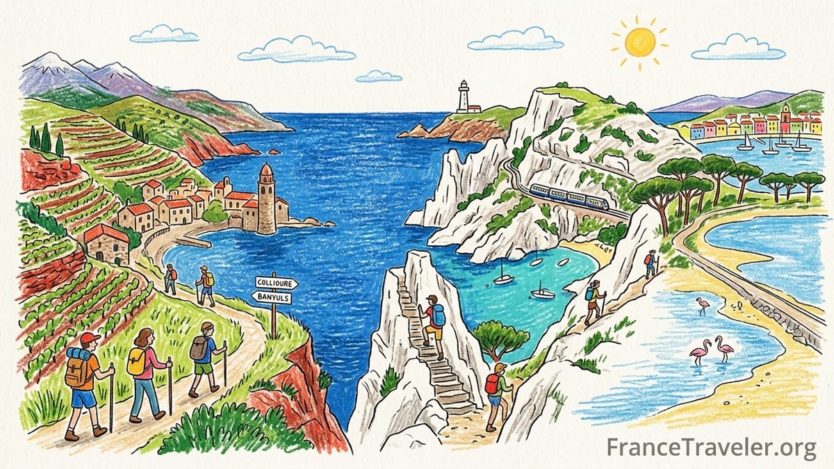
Côte Vermeille: Clifftop Paths Between Vineyards and Coves
At the Spanish border in Occitanie, the Côte Vermeille offers some of the most dramatic coastal walking in France. Here the last foothills of the Pyrenees fall straight into the sea, with terraced Banyuls and Collioure vineyards clinging to steep red schist slopes. A classic section of the Sentier du Littoral runs roughly between Collioure, Port‑Vendres and Banyuls‑sur‑Mer, following old customs paths above rocky coves. Typical day walks range from about 8 to 12 kilometres one way, with several short, steep climbs and stone steps that make them moderate rather than easy.
Public transport makes linear hikes straightforward. Local TER trains link Argelès‑sur‑Mer, Collioure, Port‑Vendres, Banyuls‑sur‑Mer and Cerbère in under 15 minutes between each stop, so many walkers start in Collioure, follow the coast past Cap Béar and Port‑Vendres, then return by train. Expect exposed walking with little shade; in summer a lightweight sun hat, at least 1.5 litres of water per person for a half‑day, and grippy footwear are essential, as some descents on loose gravel can feel airy after dry spells.
Swimming possibilities are excellent. Below the trail you will find small pebble coves and village beaches such as Collioure’s Boramar beach or the narrow inlets tucked below the Cap Béar lighthouse. In calm weather it is realistic to hike in the cool of the morning, descend a side path for a midday swim and picnic, then catch an afternoon train back. Water shoes can be useful on the stony seabed. Seasonal restrictions mainly concern heat and wind: strong Tramontane days can whip up waves and make cliff sections feel wild, even if the paths remain open, so always check local forecasts before committing to the more exposed capes.
Leucate & Narbonnaise: Wide Beaches, Lagoons and Easy Sand Walking
North of the Côte Vermeille, the coast flattens into the wide lagoons and barrier beaches of the Narbonnaise region and Cap Leucate. Here the Sentier du Littoral is less about steep climbs and more about long, breezy walks on sand, dune tracks and low clifftops. Distances can be flexible: many visitors walk short sections of 6 to 10 kilometres between resort car parks or from Leucate‑Plage around the limestone headland and back.
These routes suit beginners or families who want big skies and sea views without technical terrain. Underfoot you will mainly encounter compacted sand paths, wooden boardwalks over protected dunes and easy tracks along lagoon edges. Because the landscape is open, wind exposure is high and shade limited. Summer afternoons can feel punishing, so aim for early‑morning or late‑day walks and carry plenty of water even if you are only planning a two‑hour outing.
Swimming is possible at almost any point along the sandy beaches, with lifeguarded zones in season in larger resorts such as Leucate and La Franqui. On windy days you may share the shoreline with kitesurfers and windsurfers; in those conditions, wave and board traffic can make swimming less comfortable, so many walkers choose calm days for combining hikes and sea dips. Public‑transport access is more limited than near the bigger cities, but seasonal buses run to Leucate and some coastal resorts, and regional trains serve nearby inland towns, so a rental car or bike often gives the most flexibility for stitching together one‑way hikes.
Camargue & the Rhône Delta: Wild Wetlands at the Edge of the Sea
Between Montpellier and Marseille, the Camargue spreads across the Rhône delta in a patchwork of lagoons, salt flats and marshes. Walking here is different from most Mediterranean coasts: flat, horizon‑to‑horizon landscapes, flocks of flamingos feeding in pinkish ponds and white horses grazing behind reed beds. Instead of tight cliff paths, expect long, straight tracks along dikes and between lagoons, where a typical route might cover 10 to 15 kilometres with almost no ascent but constant sun and wind exposure.
Day walkers often base themselves in Saintes‑Maries‑de‑la‑Mer and explore out‑and‑back along the coast or lagoon edges. Public buses from Arles provide access without a car, and from Saintes‑Maries you can simply follow marked tracks toward the sea. Underfoot, gravel and sandy farm tracks make the walking technically easy, but the monotony, lack of shade and strong Mistral or sea breezes can be tiring. Good sun protection, a windproof layer and enough water for the full outing are far more important here than mountain boots.
Swimming is straightforward along the long open beaches west and east of Saintes‑Maries‑de‑la‑Mer, though facilities thin out quickly beyond the town. Because this is a sensitive wetland area, stick to established paths and respect seasonal restrictions that may protect nesting birds or rice fields. Mosquitoes can be intense from late spring to early autumn, especially near dusk, so many hikers choose morning walks and carry repellent. Fire closures are generally less of an issue here than in the pine‑forested hills around Marseille and the Var, but summer heat still argues for shorter routes and early starts.
Côte Bleue & Marseille’s West Coast: Hidden Calanques by Train
West of Marseille, the lesser‑known Côte Bleue runs from L’Estaque to Carry‑le‑Rouet and Sausset‑les‑Pins. A small coastal railway links a string of fishing coves such as Niolon, La Vesse and Méjean, making this one of the easiest areas for car‑free coastal hiking. The classic route between Niolon and Méjean follows a customs path known locally as the Sentier des Douaniers or Sentier du Littoral. It is around 7 kilometres one way, with roughly 250 metres of cumulative ascent and descent, and usually takes about three hours at a steady pace, not counting swimming stops.
The path clings to limestone slopes above turquoise calanques like l’Érevine, where steep side trails lead down to pebble beaches framed by viaducts of the Côte Bleue railway. Parts of the route are rocky, narrow and occasionally exposed, with short scrambling or hand‑assisted steps, so it is best suited to reasonably fit walkers with proper shoes rather than flip‑flops. In dry weather the white limestone reflects the sun strongly; temperatures regularly exceed 30 degrees Celsius in July and August, so many locals treat this as a shoulder‑season hike for spring or autumn.
Swimming is a central part of the experience. It is common to start from Niolon station in the morning, hike an hour to calanque de l’Érevine, take a long swim and picnic, then continue to Méjean for a late lunch at the small harbour before catching the train back. Train frequencies are modest and sometimes reduced on strike days or during line works, so checking the timetable the day before is wise. The area can be affected by the same fire‑risk closures as the Calanques National Park to the east, particularly in peak summer; on “red” risk days the authorities may close forested massifs along the coast, including parts of the Côte Bleue, so always verify access conditions locally or via official channels before setting out.
Calanques National Park: Iconic Limestone Fjords with Summer Controls
The stretch of cliffs and fjord‑like inlets between Marseille and Cassis is protected as the Calanques National Park and is one of France’s flagship hiking destinations. Signature routes include day walks to calanques such as Sugiton, Morgiou and En‑Vau, with distances typically between 6 and 12 kilometres round trip and 300 to 500 metres of ascent. Terrain is rugged and stony, with sections of loose scree and short, steep scrambles that move these hikes into at least moderate difficulty, and sometimes strenuous in hot weather.
Access from Marseille is straightforward via city buses to trailheads like Luminy, Callelongue or Les Baumettes, while from Cassis you can start directly from the port area and climb toward Port‑Miou and En‑Vau. Many visitors underestimate the heat and lack of shade: even in late May, rock temperatures and reflected glare can make midday walking tough. Good trail shoes, at least two litres of water per person, a hat and light long sleeves are strongly recommended, and those with knee issues may find trekking poles helpful on steep descents.
Swimming is possible in most of the main calanques, but you often need to commit to a full hike in and out, with no facilities on the beach itself. Calanque d’En‑Vau, for instance, is famed for its high cliffs and clear, often cool water but involves steep access paths. During peak season you may find beaches crowded by late morning, so early starts are essential if you want quieter conditions. Boat trips from Marseille or Cassis offer an alternative, but they do not replace the immersive experience of hiking in.
Summer access management is particularly strict here. Between roughly 1 June and 30 September, daily access to the park’s forests depends on wildfire risk levels. On the highest “red” risk days, land access to much of the park can be completely closed, even if the sea looks calm. In addition, the park has introduced a free but mandatory reservation system for visiting the Calanque de Sugiton and the Pierres Tombées sector on selected dates, especially weekends in June and almost every day in July and August. Reservation slots can be snapped up quickly on release mornings, so planning several weeks ahead is prudent if your heart is set on Sugiton. Even with a reservation, closures for fire risk override access, so always check the official information on the morning of your hike.
Var Coastal Paths: Classic Sentier du Littoral Between Cliffs and Resorts
East of Marseille, the Var department showcases the longest continuous network of Mediterranean coastal paths in France, with more than 200 kilometres of Sentier du Littoral threading between Six‑Fours‑les‑Plages, Toulon, Hyères, Le Lavandou, Saint‑Tropez and Saint‑Raphaël. These routes follow historic customs officers’ paths, weaving between rocky capes, pine woods and resort beaches. Many sections are waymarked and broken into manageable stages of 8 to 15 kilometres, developed by local authorities to highlight coastal scenery while keeping walkers away from busy roads.
A popular area for visitors is the coast around Hyères and the Giens Peninsula, where you can combine mainland walks with boat trips to the Îles d’Hyères. The mainland trails often mix shaded stretches under umbrella pines with more exposed cliff paths above small coves. Difficulty is generally easy to moderate: there are fewer big climbs than in the Calanques, but frequent rocky steps and occasional short scrambles keep the walking interesting and unsuitable for strollers. Sturdy sandals or trail shoes work well for days involving both hiking and swimming stops.
Swimming options along the Var coast are almost continuous in summer, from sandy beaches such as those near La Londe‑les‑Maures to wild rocky inlets accessible only on foot. Some sections cross protected headlands where there are no lifeguards or services, so you need to be self‑sufficient with water, snacks and a basic first‑aid kit. Public transport is better than many visitors expect: regional trains stop at major coastal towns like Toulon, Hyères and Saint‑Raphaël, and seasonal buses link many smaller resorts, allowing you to walk one way and return by bus or train rather than retracing your steps.
As in the Calanques, wildfire management affects hiking plans. The Var authorities may close coastal massifs and interior forests on days of extreme risk, particularly during late July and August heatwaves. Information is usually available the preceding evening, but conditions can change quickly with wind. When the paths are open, early‑morning starts help you avoid the hottest hours and make it easier to find parking near popular trailheads, which can fill up by mid‑morning in August. Many experienced walkers treat September and October as the ideal season: sea temperatures remain warm enough for swimming, but temperatures are milder and fire closures less frequent.
Esterel Cliffs & Red Rock Calanques Between Cannes and Saint‑Raphaël
Between Saint‑Raphaël and Cannes, the Esterel Massif drops to the sea in a tangle of red volcanic cliffs, arguably the most colourful stretch of the French Riviera. Here the coastal paths offer spectacular contrast between rust‑coloured rock, dark green pines and deep blue water. Some of the best coastal hiking starts near Agay or Anthéor, where you can climb short distances inland for views over both the massif and the sea, then loop back via shoreline tracks. Day hikes typically range from 8 to 14 kilometres with 300 to 500 metres of ascent, making them moderate outings.
Public‑transport access is very convenient. The coastal railway between Cannes and Saint‑Raphaël has small stations such as Anthéor‑Cap‑Rouge and Le Trayas right by trailheads, so you can step off the train and be on a path within minutes. Terrain alternates between narrow, rocky paths and wider fire roads; some coastal segments are rough underfoot and not fenced, so anyone with vertigo should choose routes carefully. During and after rain, the red rock can be slippery, but for most of the long summer season the ground is dry and dusty and sturdy shoes suffice.
Swimming is again a highlight. Small calanques such as those near Île des Vieilles or Calanque de Maupas are accessible via steep side paths, where you can find deep natural swimming pools in calm conditions. There are fewer sandy beaches here than along the Var coast to the west, so many walkers bring light water shoes for rocky entries. Seasonal lifeguards are present only at designated coves near villages; in remote inlets you need to assess sea state yourself and beware of boat traffic close to shore.
Wildfire closures can be frequent in the Esterel during high‑risk periods, and access roads or popular trailheads may be barred on “very severe” days. Local authorities publish maps indicating whether each massif is open, partly open or closed for the day, and these rules apply just as much to casual coastal strollers as to serious hikers. As elsewhere on the Mediterranean, smoking on trails and making any kind of fire, including portable barbecues, is strictly forbidden and subject to significant fines. Because the Esterel combines both dense pine forest and steep, rough ground, it is doubly important not to be caught high on an exposed path if a closure or evacuation is announced.
Cap d’Antibes, Cap Ferrat & Côte d’Azur Promenades
On the eastern Côte d’Azur, coastal walking shifts again in character, from wild massifs to manicured villa peninsulas and historic promenades. Cap d’Antibes and Saint‑Jean‑Cap‑Ferrat both offer excellent short coastal circuits on paved or well‑engineered paths, with constant sea views and glimpses of some of the Riviera’s most exclusive properties. Distances are modest: for example, a full loop around Cap d’Antibes or Cap Ferrat is typically around 7 to 10 kilometres, mostly flat, making these suitable for half‑day walks with plenty of photo and café stops.
Underfoot, expect a mix of stone‑slab paths, steps and occasional gravel tracks. There are intermittent railings above drops, but in general the walking is not technically demanding, and many sections attract local joggers and dog walkers. Public transport is straightforward, with frequent trains to Antibes and Beaulieu‑sur‑Mer, and local buses to Saint‑Jean‑Cap‑Ferrat. This makes it easy to stay in Nice or Cannes and visit for a day without a car. Because these are residential peninsulas, parking near the trailheads can be challenging in peak season, so arriving by bus or on foot from the nearest train station often saves stress.
Swimming opportunities are plentiful but more urban in feel than in the Var or the Calanques. Small public beaches and rocky platforms are squeezed between private properties, and some stretches have seasonal beach clubs that rent sun loungers and umbrellas. It is entirely possible to walk an hour along the path, drop down steps to a tiny cove for a dip, then continue to a café terrace for an espresso or ice cream. There are no wild‑land fire closures in the same sense as in the pine‑covered massifs, but summer heat and reflective white stone can still make midday walking uncomfortable. Early morning and sunset strolls show these peninsulas at their best light, with the added bonus of quieter paths.
Further east, short stretches of coastal path also run between Nice and Villefranche‑sur‑Mer and around the headlands toward Cap de Nice. These are typically urban or semi‑urban “chemin du littoral” promenades, paved or concreted, that cling to the rock face just above the water. They are ideal for travellers who want a sea‑level walk without significant ascent or navigation challenges, and they combine easily with city sightseeing, museum visits and restaurant stops.
The Takeaway
From the Spanish border to the Italian frontier, the French Mediterranean coast offers a remarkable variety of hiking experiences packed into a few hundred kilometres of shoreline. The rugged terraced cliffs of the Côte Vermeille, the big‑sky lagoons of the Camargue, the dramatic limestone fjords of the Calanques, the long customs paths of the Var and the polished promenades of the Côte d’Azur all reveal different faces of the same sea. With regional trains, coastal buses and dense networks of Sentier du Littoral paths, it is entirely possible to design a multi‑day journey that stays close to the water line the whole way.
Planning around summer conditions is crucial. Heat, limited shade and wildfire risk shape when and where you can safely walk, especially between late June and late August. In the Calanques and along some forested coastal massifs in the Var and Esterel, day‑by‑day access rules and, in the case of Sugiton, advance reservations, are now part of the experience. Build flexibility into your itinerary, have easier urban or lagoon walks as backup options for high‑risk days, and treat dawn starts as normal rather than exceptional.
For most walkers, the shoulder seasons from late April to early June and from September into October offer the best balance of open trails, swimmable seas and manageable temperatures. Whether you are planning a single highlight hike like Niolon to Méjean or aiming to link multiple regions in one extended trip, focusing on the coast’s official paths and using public transport to connect them will give you a richer, lower‑stress encounter with the French Mediterranean than simply driving from one beach to the next.
FAQ
Q1. What is the easiest coastal hike on the French Mediterranean for beginners?
The flattest, least technical options are usually around Cap d’Antibes, Cap Ferrat and the urban coastal promenades near Nice and Villefranche‑sur‑Mer, where paths are mostly paved, distances are 5 to 8 kilometres and you can turn back at any time without committing to steep climbs or descents.
Q2. When is the best season to hike the Calanques safely?
The most comfortable periods are typically late March to early June and late September to early November, when temperatures are milder and wildfire closures less frequent, though you should still check daily risk levels and access rules before going.
Q3. Do I really need a reservation to visit the Calanque de Sugiton?
In recent summers the national park has required free but mandatory reservations for Sugiton and the nearby Pierres Tombées sector on specific high‑season dates, especially in July and August, and this system is expected to continue, so you should plan as if a reservation will be needed.
Q4. How can I check if trails are closed due to fire risk?
Departments along the Mediterranean publish daily information about forest and massif access in summer, and the Calanques National Park provides updates on whether land access is authorised or closed; always consult official channels on the morning of your hike rather than assuming a trail is open.
Q5. Are coastal paths like the Var Sentier du Littoral suitable for children?
Many sections near resorts such as Hyères, Le Lavandou or Saint‑Raphaël are family‑friendly, with short stages, escape points to beaches and only modest elevation changes, but parents should avoid cliff‑edge segments in strong wind and always supervise children closely near unfenced drops.
Q6. Can I do these hikes without renting a car?
Yes, several key areas are very accessible by public transport, including the Côte Vermeille between Collioure and Cerbère, the Côte Bleue villages by local train, the Calanques via Marseille buses, and the Esterel and Côte d’Azur headlands using the coastal railway and local buses.
Q7. What kind of footwear is best for French Mediterranean coastal hikes?
On rocky paths such as the Calanques, Côte Bleue, Esterel and much of the Var, closed‑toe trail shoes or light hiking boots with good grip are strongly recommended, while on flatter promenades around Cap Ferrat or Antibes, sturdy trainers are usually sufficient.
Q8. Is wild camping allowed along the coastal trails?
Wild camping and bivouacking are heavily restricted or outright forbidden along much of the French Mediterranean coast, especially in protected areas like the Calanques National Park and the Var coastal massifs, so visitors should plan to stay in official campsites, guesthouses or hotels instead.
Q9. How much water should I carry on a typical summer hike?
Because shade and freshwater sources are scarce, many local hikers carry at least 1.5 to 2 litres per person for a half‑day outing and more for longer, exposed routes, particularly in July and August when temperatures often exceed 30 degrees Celsius.
Q10. Are there guided hikes available if I am not confident navigating alone?
In most major coastal resorts and cities, including Marseille, Cassis, Hyères and Saint‑Raphaël, local guides and outdoor agencies offer half‑day or full‑day guided coastal hikes, which can be a good option if you want help choosing a route suited to your fitness and the current conditions.