


I drove Normandy the way many travelers imagine it on a map, turning a thin line of ink into a week of real asphalt, village roundabouts and windswept coastal parking lots. My route linked Rouen, Étretat, Honfleur, the D-Day coast around Bayeux and finally Mont-Saint-Michel, with slow, cider-scented detours through the Pays d’Auge. Along the way I misjudged driving times, overstuffed a couple of days, paid more than expected at toll booths and learned exactly where an overnight stop saves hours of backtracking. This is that route as it actually unfolded, from the driver’s seat, for anyone planning to follow the same arc across Normandy.
Planning a Realistic Normandy Route and Rental Car
I started and finished this loop with a rental car picked up in Rouen, which already saved time and parking stress compared with collecting a car in Paris. Rouen is large enough to have mainstream rental agencies near the station and close access to major routes, but still compact enough that you are not immediately thrown into multi-lane urban traffic. I chose a small petrol hatchback, roughly the size category the rental sites call “compact,” which mattered later when squeezing into village parking and narrow lanes in the Pays d’Auge. Manual transmission remains standard, with automatics often priced higher and in shorter supply, so booking well ahead was essential.
For navigation, a mixture of the in-car system and a smartphone map app worked best. Mobile coverage across my route was generally strong, including on the D-day coast and around Mont-Saint-Michel, but there were small dead patches between villages inland. I downloaded offline maps beforehand and was glad I had them when a farm track detour appeared without warning. Fuel prices during my trip fluctuated around the levels shown on French fuel comparison sites, and the cheapest refills were at hypermarket stations near Rouen and Caen rather than at small coastal towns.
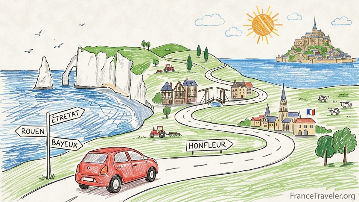
The backbone of this itinerary, if you trace it on a road atlas, looks like Rouen to Étretat, then down to Honfleur, on to Bayeux and the D-Day beaches, and finally southwest toward Mont-Saint-Michel. On paper the distances look modest. In reality, coastal traffic, 80 km/h limits on secondary roads, and photo stops stretch days much longer than expected. My original plan tried to squeeze Rouen, Étretat and Honfleur into one day, then run Honfleur to Bayeux with a Pays d’Auge side-loop the next. In practice, I needed an extra night to make the route feel like travel rather than a timed delivery run.
Weather also shapes driving comfort in Normandy. I had a summer mix of sudden showers and long patches of low, bright sun that made westward evening driving tiring. Roads are generally well maintained, but spray and glare on dual carriageways like the A13 can be intense after storms. Having decent sunglasses, a microfiber cloth for the windscreen and flexibility in departure times made that manageable.
Rouen to Étretat: First Cliffs and Coastal Parking Reality
Leaving Rouen, I joined major routes toward the coast, eventually picking up the A13/A29 corridor that funnels traffic toward Le Havre and the Alabaster Coast. This section was the first introduction to tolls. On my date of travel the segment north of Rouen incurred a charge just under 10 euros according to my receipt, broadly matching current reports from drivers discussing the A13 and related autoroutes. Using toll roads here cuts the journey time to roughly 1 hour 30 minutes under light traffic. Skipping tolls and threading entirely along departmental roads pushes that close to 2 hours, with many roundabouts but also more glimpses of farmland and half-timbered houses.
The final approach to Étretat leaves the faster roads and swings onto smaller departmental routes. These are mostly smooth, single-carriageway roads with frequent speed changes as they pass through villages. On a clear weekday late morning I averaged closer to 60 km/h overall than the nominal 80 km/h limit because of tractors, delivery vans and cautious locals. The road pinches slightly near the entrance to Étretat, where signage doubles and traffic suddenly feels more coastal and holiday-focused. Electronic signs warned about full parking lots before I could even see the sea.
Parking in Étretat is the first real stress test of Normandy coastal driving. I followed the official signs to the main car parks on the edge of town, including long-stay options such as the parking near the Route du Havre and the Fréfossé area that local tourism information highlights. Daily rates are clearly posted at the entrances, and machines accept cards. When I arrived in high season late morning, the closer bays near the beach were already effectively saturated, and attendants were waving cars toward more distant rows. I learned quickly not to gamble on free spots along the departmental road shoulders; local authorities explicitly caution against obstructive parking near the entrances to town and along roads like the Route de Criquetot and toward Bénouville, where fines and towing are real risks.
From the car park I walked 10 to 15 minutes down to the pebble beach and the famous chalk cliffs. I had imagined a quick two-hour stop. In practice, between queueing for parking, walking in and climbing up to at least one of the cliff-top paths, I spent over four hours in Étretat. That mattered for the rest of the day’s driving. If you want to see both sides of the cliffs at an unhurried pace and maybe visit the gardens above, Étretat works better as either a morning-only stop with an early arrival before 9 a.m. or as the main focus of the day. Folding it into a multi-stop day from Rouen leaves little margin for delays.
Étretat to Honfleur: Short Drive, Heavy Summer Congestion
On the map, Étretat to Honfleur is an easy hop. My navigation estimated 1 hour 15 minutes along a mix of departmental roads and stretches near Le Havre and the Pont de Normandie. Without traffic, that is realistic. My actual drive, departing Étretat around 4:30 p.m. in August, took closer to 2 hours. The bottlenecks were the approach toward Le Havre and the inevitable compression of vehicles funneled toward the river crossing. Roundabouts filled with caravans and motorhomes slowed progress, and short local back-ups meant long first and second gear stretches.
The Pont de Normandie itself is a tolled bridge that carries you over the Seine estuary toward Honfleur. Toll prices for passenger cars have been hovering in the mid single-digit euro range in recent years, and my transaction at the booth was in that bracket. Paying by contactless card took seconds, but the brief queue at the plaza added to the sense that every segment on this route accumulates a few extra minutes. The ascent and descent of the bridge are straightforward, yet the strong coastal wind was noticeable, nudging the car gently sideways. Drivers of higher vehicles like campervans need to be particularly attentive here.
Honfleur announces itself with slow-moving traffic curling around its outskirts and into the old harbor. My accommodation for this night was in walking distance of the Vieux Bassin, but I chose a paid public parking lot a little outside the medieval core. Honest lesson: arriving in Honfleur after a full Rouen and Étretat day left me with enough energy only for a harbor stroll and dinner, not the detailed exploration the town deserves. In retrospect, if I were repeating this trip and wanted time in Honfleur’s galleries and side streets, I would either skip Étretat that day and come direct from Rouen or stay two nights in Honfleur and visit Étretat as a dedicated day trip up and back.
Traffic noise aside, the drive between Étretat and Honfleur passes through rolling farmland and occasional glimpses of the industrial port around Le Havre. It is not a purely bucolic route, and at times it feels like a practical transit leg between highlight destinations. That becomes relevant when deciding where to place overnight stops. Honfleur worked well as my first base because it prevented a long evening push all the way to Bayeux, but I recognized that I had tried to feed three significant experiences into one day, and the last of them inevitably suffered.
Honfleur, Pays d’Auge and the Push to Bayeux and the D-Day Coast
Leaving Honfleur the next morning, I faced a choice. The direct route to Bayeux along major roads near Caen is efficient, roughly 1 hour 30 minutes under normal traffic. Yet some of Normandy’s most inviting countryside lies to the south in the Pays d’Auge, home to cider orchards, half-timbered farmsteads and villages like Pont-l’Évêque, Beuvron-en-Auge or Cambremer. I chose the scenic option, which was rewarding but expanded the day’s driving far beyond what I had budgeted for the D-Day coast.
The Pays d’Auge roads are smaller and slower than the coastal highways. Expect frequent blind bends, narrow shoulders and occasional meetings with agricultural machinery. Surfaces were mostly good, but I often dropped to 50 km/h or less through hamlets. Distances between named villages look tiny on the map, yet clusters of roundabouts and 30 km/h zones stretch them out. I stopped at a farm cider producer near Cambremer where a small car park held only a half dozen vehicles, underscoring how much easier this terrain is in a compact hatch than in a bulky SUV.
By the time I rejoined larger roads toward Bayeux, it was mid-afternoon. The final leg, including a bypass of Caen and the run toward Bayeux on dual carriageways, moved more quickly, but the total driving time from Honfleur via the Pays d’Auge climbs to three hours or more, not the neat 90 minutes of the direct route. This compression meant that my first planned D-Day site, the Pegasus Bridge area near Caen, was reduced to a quick look instead of a proper museum visit.
Bayeux itself is the most practical base for exploring the D-Day coast by car. Its compact center is ringed by several medium-sized car parks, some free for limited periods, and even paid parking rates are modest compared with Mont-Saint-Michel. I stayed two nights, which in hindsight was the single best decision of the trip. It eliminated the temptation to rush along the beaches and allowed one full day dedicated to the landings, plus time for the tapestry and cathedral. Had I split nights between Bayeux and a smaller village like Arromanches or Port-en-Bessin, I would have spent too much time packing, checking in and learning new parking rules for marginal gain.
Driving the D-Day Beaches: Distances, Small Roads and Emotional Fatigue
With Bayeux as a base, I planned a loop that covered Arromanches, Omaha Beach, the American Cemetery, Pointe du Hoc and Utah Beach. On a map, these dots line up neatly, but the reality on the ground is slower. Roads between sites are a patchwork of D-roads and farm lanes, some hugging the coast, others weaving inland. My full loop, with stops and minor detours, accounted for roughly 160 to 180 kilometers and about four hours of pure driving time, not including walking around museums and memorials.
From Bayeux to Arromanches took about 20 minutes on a clear morning along secondary roads through open fields. Parking above the remains of the artificial Mulberry harbor is in marked lots on the hillside, and arrival before 10 a.m. made it relatively simple to find a space. As the day went on, these lots filled, and cars began circling for spaces, similar to the pattern I had seen in Étretat. Parking charges here were modest, payable at machines, and I made a note that carrying a few coins still helps even when card payment is theoretically available.
The stretch from Arromanches west to Omaha Beach and the American Cemetery near Colleville-sur-Mer took around 40 minutes in traffic that thickened near each major site. Small junctions and occasional queues to turn left into memorial parking areas created micro delays. At Omaha I parked in the official beachfront lot, where clear signage pointed to zones for cars versus coaches. The atmosphere along these roads is heavy, and I found that emotional fatigue from the content of the sites compounded physical driving fatigue later in the day. By the time I reached Pointe du Hoc, down another series of small lanes, my concentration was fraying.
In hindsight, I had overloaded that day. Squeezing Utah Beach into the same loop required a significant extra detour, more than an hour of additional driving, and I felt it. If I repeated this road trip, I would either trim one major site from the circuit or prioritize a guided tour one day and a shorter self-drive the next. The key lesson for anyone using a rental car along the D-Day coast is that while distances are short, each stop involves parking, orientation and often uphill walking from the lot to the memorial, all of which extend the day beyond what a navigation estimate implies.
Bayeux to Mont-Saint-Michel: Tolls, Parking Systems and Shuttle Logistics
Leaving Bayeux for Mont-Saint-Michel, I intended to drive efficiently rather than sightseeing. The fastest route runs via the Caen ring road and then southwest on a mix of dual carriageways and national roads toward Avranches. Travel time on a navigation app showed about 2 hours 30 minutes, which matched my actual experience when departing after breakfast on a weekday. I encountered modest congestion near Caen and some slower stretches behind trucks on single carriageway segments, but overall it felt like a straightforward transfer day.
There are no toll sections between Bayeux and Mont-Saint-Michel that compare to the A13 corridor near Rouen, so my toll expenses on this leg were minimal. Fuel, however, is worth planning. Service stations on dual carriageways post higher prices than supermarket stations in towns; I refueled near Caen at a large retail complex where the posted per-liter price undercut small village pumps by a noticeable margin. Spacing fuel stops so that you do not arrive at Mont-Saint-Michel running nearly empty is wise, because by the time you enter the dedicated approach roads you are focused on signs for parking rather than hunting for a petrol station.
The approach to Mont-Saint-Michel is tightly managed. Private vehicles must park in large lots on the mainland, from which a dedicated pedestrian route and shuttle buses lead to the Mont. The official parking operator now collaborates with a major transport company, and the system involves barrier gates, entry tickets and payment at machines on exit. Parking tariffs vary by season and time of day, and official information explains that parking is free from the early evening to the early morning for much of the year, with the first 30 minutes of any stay also free across seasons. I arrived in the late morning and paid for day parking, which included access to the site’s free shuttle network.
From the car parks it is about a 20-minute shuttle ride to the base of Mont-Saint-Michel, with an alternative option to walk along the causeway that can take 30 to 40 minutes depending on pace and photo stops. Official visitor guidance suggests allowing roughly an hour from the moment you park to the point where you step into the abbey itself, factoring in shuttle waits, walking and the uphill climb through the village. That estimate proved accurate. The shuttles, branded and designed specifically for this route, operate frequently through the day, though queues lengthen in peak hours. On my visit the park-and-ride felt efficient, but I understood why day-trippers who also attempt a long drive in and out on the same day describe the schedule as tight.
Parking near the hotels built along the access road behind the dikes follows a slightly different system, involving entry codes supplied by the accommodation and private lots within the controlled zone. I chose to stay in the mainland hotel area within walking distance of the shuttle stop, which meant I did not need to re-enter the general car parks for a second day visit. That saved at least half an hour each way and reduced backtracking within the parking complex itself. For anyone planning to see Mont-Saint-Michel by day and again illuminated at night, building in an overnight stop somewhere near the causeway is almost essential.
Overnights, Backtracking and What I Would Skip Next Time
Looking back across the route, some overnight choices worked extremely well, while others amplified fatigue. Honfleur, as a first coastal stop after Rouen and Étretat, prevented an exhausting late-night arrival in Bayeux, but it also became the town I saw the least of because of the long preceding day. Bayeux, with two consecutive nights, emerged as the most efficient and satisfying base of the trip. It eliminated repeated packing and parking routines and allowed a full day on the D-Day coast without pressure to move accommodations in the evening.
Mont-Saint-Michel as an overnight rather than a rushed stop at the end of a long driving day was transformative. Checking into a nearby hotel in the afternoon, visiting the Mont for sunset and then returning early the next morning for quieter streets gave the experience a depth I would have missed on a pure day trip from Bayeux or Caen. It also simplified driving logistics, as I could leave the car parked for a prolonged period and spread the parking fee across two visits instead of punching in and out of the system twice.
If I repeated this itinerary, the first detour I would skip is trying to give Honfleur full justice on the same day as Rouen and Étretat. Those harbor cafés and steep side streets will be there tomorrow. I would either stay in Rouen the first night, visit Étretat very early and then move on to Honfleur by lunchtime, or cut Rouen’s sightseeing shorter and keep only two major stops that day. Another place I might reduce is the farthest reaches of the D-Day coast in a single loop. Attempting to include both Pointe du Hoc and Utah Beach in the same day as Omaha, the American Cemetery and Arromanches pushed the experience from reflective to rushed.
The Pays d’Auge diversion was beautiful but costly in time. For travelers tightly focused on war history and Mont-Saint-Michel, I would suggest saving those half-timbered villages for a future dedicated trip or trimming the loop to one or two representative stops close to the main Bayeux–Caen axis. The key theme is to respect what local speeds and parking realities do to your schedule. Removing even one major stop per day often turns an anxious itinerary into a relaxed one.
The Takeaway
Driving across Normandy tied together some of France’s most powerful landscapes and historical sites in a way no train itinerary could. From Rouen’s spires to the white cliffs of Étretat, the creaking pontoons at Arromanches and the silhouette of Mont-Saint-Michel rising from the bay, the car window framed a constantly shifting sequence of scenes. But that freedom came with costs in tolls, parking fees, concentration and time. Navigation apps routinely underestimated day length because they could not account for cliff-top detours, museum queues or the time needed just to walk from distant car parks into medieval centers.
The most useful lesson from this route is that fewer overnights and more two-night stays near key hubs save you more backtracking than any clever shortcut along farm roads. Rouen works as an arrival and car collection point, Honfleur or the surrounding coast can be a gentle introduction if not overloaded, Bayeux anchors the D-Day coast, and Mont-Saint-Michel deserves at least part of two days and an overnight nearby. Tolls on autoroutes like those near Rouen and on the Pont de Normandie are manageable when weighed against time saved, while fuel costs can be contained by filling up at larger supermarket stations.
If your own map of Normandy currently looks like a necklace of famous names connected by single thin lines, imagine instead broad strokes of driving time: roughly 1 hour 30 minutes Rouen to Étretat with tolls, about 2 hours Étretat to Honfleur in summer traffic, 2 to 3 hours from Honfleur to Bayeux depending on inland detours, a full day’s loop for the D-Day beaches from Bayeux, and about 2 hours 30 minutes to 3 hours from Bayeux to Mont-Saint-Michel. Building days around those realities, leaving space for slow lunches and sudden showers, turns a rushed checklist into a road trip with room to breathe.
FAQ
Q1. How long does it really take to drive from Rouen to Étretat by car?
In light traffic using a mix of autoroute and national roads, Rouen to Étretat usually takes around 1 hour 30 minutes, but slower village sections and summer congestion can push it closer to 2 hours.
Q2. Are the tolls between Rouen, Honfleur and Bayeux expensive?
Tolls on the autoroute sections north of Rouen and on the Pont de Normandie together typically add up to a modest double-digit euro amount for a one-way trip, which is reasonable when balanced against the time saved compared with entirely toll-free routes.
Q3. Is parking difficult in Étretat and Honfleur in peak season?
Yes, both towns experience heavy pressure on parking in summer and on sunny weekends, with central bays filling by late morning. Arriving before 9 a.m. and using signed long-stay car parks on the outskirts greatly improves your chances of finding a space without circling.
Q4. How many nights should I stay in Bayeux for the D-Day beaches?
Two nights in Bayeux work well for most travelers, allowing one full day to explore key D-Day sites by car and enough extra time to visit the tapestry, cathedral and local restaurants without rushing.
Q5. Can I see the main D-Day beaches and Mont-Saint-Michel in a single day?
It is not practical to do both well in one day by car, because the driving alone between Bayeux and Mont-Saint-Michel takes around 2 hours 30 minutes each way. Combining that with meaningful visits at multiple D-Day sites and the Mont would make for an exhausting and unsatisfying schedule.
Q6. Is it worth detouring through the Pays d’Auge between Honfleur and Bayeux?
The Pays d’Auge offers beautiful countryside and traditional villages, but even a modest detour adds at least an extra hour of driving. It is most worthwhile if you have a relaxed schedule or a particular interest in cider, cheese and rural scenery, rather than if you are rushing to reach Bayeux for D-Day visits.
Q7. How does parking work at Mont-Saint-Michel?
Private cars park in large managed lots on the mainland, where you take a ticket on entry and pay at machines on exit. Parking fees vary by season and time of day, with some free evening and early-morning periods, and include access to the frequent free shuttle buses that run between the lots and the Mont.
Q8. Do I need a small car for Normandy’s country roads?
A compact car is more comfortable on Normandy’s narrow village streets, tight hotel car parks and small country lanes, especially in the Pays d’Auge and near some D-Day sites. Larger vehicles can manage the main routes but may find squeezing into busy car parks and passing oncoming traffic on minor roads more stressful.
Q9. Is an overnight stay at Mont-Saint-Michel necessary?
It is not strictly necessary, but staying nearby for one night lets you experience the Mont in the evening and early morning when crowds are lighter, and it reduces the pressure of fitting the approach, parking, shuttle and abbey visit into a tight day-trip window.
Q10. What was the biggest mistake in planning this Normandy road trip?
The main mistake was trying to combine three major stops on some days, such as Rouen, Étretat and Honfleur on the first coastal day and too many D-Day sites in a single loop, which left little time for unhurried visits and increased driving fatigue. Spreading those highlights across more days or trimming one stop from each day would have improved the experience.