


Northern France is one of Europe’s great road trip regions, combining compact driving distances with varied scenery, powerful wartime history and atmospheric coastal towns. With a rental car you can land in Lille or arrive by Eurostar or ferry, then fan out towards the Opal Coast, the Normandy landing beaches, Mont-Saint-Michel and the wild shores of Brittany. This guide explains how to plan the drive, what to expect from tolls and parking, and suggests realistic 5, 7 and 10 day itineraries that link the highlights without spending your holiday stuck behind the wheel.
Planning your Northern France road trip
Lille makes a convenient northern gateway because it is well connected by high-speed trains from Paris, Brussels and London, and has an international airport with major rental brands. At Lille Airport, desks for Avis, Europcar, Hertz, Enterprise, Sixt and others are grouped just outside the arrivals hall, so you can be on the A1 or A25 within minutes of touchdown. If you arrive by Eurostar at Lille Europe station, most of the same companies operate in-terminal or nearby city branches, and you can walk to pick up the car.
For this route, a compact or intermediate car is usually the sweet spot. A small hatchback such as a Renault Clio or Peugeot 208 is easier to thread through medieval town centers like Bayeux or Saint-Malo and will fit in tight underground car parks. Families or small groups may prefer a compact SUV like a Peugeot 2008 or Nissan Qashqai for extra luggage space and a higher driving position without going up to a full-size SUV that can be awkward on narrow Breton lanes.
Manual gearboxes are still the default on many French rental fleets, and automatics can cost noticeably more and sell out in peak season. If you cannot drive a manual, reserve an automatic months in advance, especially for July and August. Check that your rental includes unlimited mileage and basic insurance, and consider reducing the excess, as coastal parking and small-town streets can mean the occasional scrape.
Most visitors from North America or the UK do not need an International Driving Permit for France if they hold a license in Roman script, but it is worth checking current rules with your rental company before you travel. Bring a physical credit card in the driver’s name for the security deposit, and carry your passport in the car because you may be asked for ID at some hotels or in the event of a roadside check.
Tolls, fuel and practical driving tips
Northern France mixes toll motorways with excellent free national roads. Around Lille, the A1 and A25 are free, but as you head towards Normandy you will encounter tolled sections such as parts of the A13 between Rouen and Caen. As a rough guide, driving from Lille to Caen via the faster motorway route can cost in the region of tens of euros in tolls one way, depending on your exact route and current tariffs. If you prefer to save money and see the countryside, you can use N-roads that parallel the autoroutes at the cost of 30 to 60 extra minutes of driving.
Toll plazas accept credit cards and cash. For a smoother run in peak holiday periods, some rental companies offer an electronic toll tag as a chargeable extra, which allows you to use the orange “t” lanes that read your tag automatically. It is not essential for this trip, but it can cut queues around busy stretches near Rouen or around the Caen ring road in summer.
Fuel stations are frequent on motorways and at the edges of towns. Supermarkets such as E.Leclerc, Intermarché and Carrefour often have cheaper self-service pumps on the outskirts, where you pay by card at the machine. Standard unleaded is labelled SP95 or SP98, and diesel is simply “gazole.” It is worth topping up before long coastal stretches in Brittany, where you may drive for an hour between larger towns.
Driving rules are straightforward. You drive on the right, overtake on the left, and speeds are generally 130 km/h on motorways in dry conditions, 110 km/h on divided highways, and 80 or 90 km/h on other roads, with 50 km/h through built-up areas unless signed otherwise. Many French towns now have extensive 30 km/h zones and traffic-calming measures, especially in historic centers such as Bayeux and Saint-Malo, so expect slower progress and watch for speed cameras on entry and exit roads.
From Lille to the Opal Coast and Normandy
Leaving Lille, the quickest way to the Channel is the A25 towards Dunkirk and the A16 along the Opal Coast, a run of about 1.5 hours to the Cap Blanc-Nez and Cap Gris-Nez headlands. The D940 coastal road, signed as the Route des Caps in places, twists along chalk cliffs and dunes with constant sea views. Between Wissant and Audresselles you will find small seaside resorts with paid parking areas on the seafront, where parking meters usually accept coins and sometimes cards. Arriving early in high season gives you the best chance of a seafront spot.
Many road trippers then continue along the Channel past Boulogne-sur-Mer and Le Touquet, or cut inland via the Baie de Somme towards Rouen. The D940 and parallel D940E through the Somme estuary are scenic, with marshes, birdlife and pretty halts such as Saint-Valery-sur-Somme. Allow time for slower traffic behind campervans and cyclists, particularly at weekends and in school holidays.
From the Opal Coast, one option is to turn inland to Rouen and then follow the valley of the Seine towards Honfleur and the Normandy coast via the Pont de Normandie bridge. This striking cable-stayed bridge carries the A29 over the river, and the crossing carries a modest toll for passenger cars. On the far side you reach Honfleur, where a multi-storey car park near the harbourfront and a large surface lot by the old docks provide straightforward parking, although they can fill by mid-morning in July and August.
Continuing west, the A13 and its parallel D-roads lead towards Caen, from where you can branch north to the D-Day beaches or south towards the Suisse Normande hills if you want a rural overnight break. Caen itself has several city-centre underground car parks and is a convenient base with direct access to the N13 that runs along the landing coast.
Driving the D-Day beaches and classic Normandy
The D-Day coastline between Ouistreham and Sainte-Mère-Église is best explored at a modest pace, using a mix of the N13 dual carriageway and the coast-hugging D-roads. Many visitors base themselves in Bayeux, which sits just inland from Omaha Beach and offers a preserved medieval center, famous tapestry and a choice of hotels with on-site or nearby parking. Bayeux’s small size makes it easy to walk to dinner after parking the car for the evening.
Key stops include Sword, Juno and Gold beaches to the east, Omaha and Utah further west, and major museums and memorials. For example, the Normandy American Cemetery near Colleville-sur-Mer overlooks Omaha Beach, and has a large free car park a short walk from the visitor center. Arromanches, with its remains of the Mulberry harbour, offers paid parking in signposted lots on the edge of town; in high season you may be directed by marshals and should follow their instructions rather than trying to nose into side streets.
The drive between sites is short, but the small coastal roads can become congested around commemorative dates, especially near 6 June. It is safer to park once in each town and walk between museums, waterfronts and viewpoints rather than moving the car every few hundred metres. Many beaches have dedicated access roads with gravel or sand car parks at the end, for example at Omaha where a road descends from Vierville-sur-Mer to the seafront. Take care if you are driving a low-slung car on uneven parking surfaces.
Beyond the landing sites, the inland Norman countryside rewards detours along narrow D-roads that thread orchards and half-timbered farmhouses. The Pays d’Auge east of Caen is a classic cider and cheese region with villages such as Beuvron-en-Auge and Cambremer, where you typically park in small free lots on the edge of the village and stroll in. These slow, winding roads contrast nicely with the more functional N13 and give a flavour of rural life.
Mont-Saint-Michel access, parking and onward to Brittany
From the western end of the D-Day coast near Carentan, the quickest route to Mont-Saint-Michel follows the A84 motorway towards Avranches, a mostly toll-free stretch that makes this hop relatively inexpensive. As you approach the Mont, roadside signs guide you to the main car park complex on the mainland. Cars are directed to colour-coded lots numbered P1, P2, P3 and so on, and larger vehicles such as motorhomes use a separate P8 area set further back. Recent access guides from the local tourist office indicate that general visitor parking is clustered a couple of kilometres from the Mont, with dedicated spaces reserved closer in for disabled badge holders.
Expect to pay a fixed fee for up to 24 hours of parking, which varies by season and vehicle type. Automated payment machines are located near the pedestrian access to the causeway and accept cards. From the car park, most visitors either walk the 2.5 km causeway or take the free shuttle buses known as “Le Passeur,” which run frequently throughout the day and drop passengers a short walk from the walls. The shuttles can be very busy in the late morning and mid-afternoon; starting early or staying until evening light can make the experience calmer.
If you are carrying luggage for an overnight stay on the Mont or in nearby hotels on the mainland, pack a small overnight bag rather than rolling large suitcases the full distance from the car park. Many travellers choose to stay in nearby villages such as Beauvoir or Pontorson, where hotels often have their own small free car parks, then drive in for a half-day visit and leave again when the crowds peak.
From Mont-Saint-Michel into Brittany, the D976 and N176 roads lead quickly towards the Emerald Coast around Saint-Malo and Dinard. This section provides a noticeable shift in atmosphere: road signs switch from “Normandie” to “Bretagne,” granite farmhouses appear, and bilingual French-Breton place names line the verges. Traffic remains fairly light outside peak weekends, although approaches to Saint-Malo can slow at rush hours as locals commute.
Classic Brittany coastal drives and scenic routes
Brittany’s north coast between Saint-Malo and the Pink Granite Coast is one of France’s great seaside drives. Around Saint-Malo itself there are several large paid car parks just outside the walled city, from which you walk through the gates into the cobbled streets. It is usually not worth attempting to drive inside the ramparts unless you have a hotel with guaranteed parking, as streets are narrow and signed with local access restrictions.
West of Saint-Malo, the roads towards Cancale and the Pointe du Grouin offer views of oyster beds and cliff-top paths. Further along, the Cap Fréhel peninsula combines heather-covered cliffs with a lighthouse and sea views. Access is via a minor road from Plévenon, which leads to a large paid parking area at the headland, from where you can walk to the lighthouse and viewpoints in a few minutes. In fine weather, this car park fills from late morning, especially with day trippers from Saint-Malo.
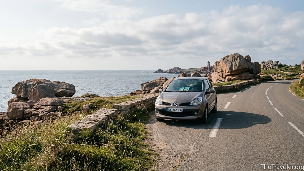
Continuing west, the Côtes-d’Armor department contains the famed Pink Granite Coast, a protected shoreline with surreal rose-coloured rock formations around Perros-Guirec, Ploumanac’h and Trégastel. Tourist information from the region describes this stretch as one of Brittany’s most striking landscapes, with giant boulders weathered by wind and waves and a coastal path, the GR34 “sentier des douaniers,” running above the sea. Road access follows small departmental roads, and several coastal segments are one-way or have tight turnarounds, so a smaller vehicle again proves useful.
Parking for the Pink Granite Coast is concentrated in lots near beaches such as Trestraou and Trestignel in Perros-Guirec, and near the harbour at Ploumanac’h. In peak summer, these lots can be full by late morning, at which point local advice is often to park further back in the town and walk in along the coastal path. Driving times between major points are short on paper, but narrow village streets, pedestrian crossings and cyclists frequently slow progress, so it is wise to allow extra time between stops.
Suggested 5, 7 and 10 day itineraries
A 5 day road trip from Lille works well for travellers who want a taste of everything without going too far into western Brittany. One realistic outline is: Day 1 Lille to the Opal Coast via the D940, visiting Cap Blanc-Nez and staying near Wimereux or Boulogne-sur-Mer. Day 2 drive to Rouen and on to Honfleur for an overnight in the old harbour area. Day 3 continue to Bayeux via the D-Day beaches, stopping at one or two key sites such as Arromanches and the American Cemetery. Day 4 drive to Mont-Saint-Michel for a half-day visit, then continue to Saint-Malo. Day 5 explore Saint-Malo and Cancale, then either return the car in Rennes for a train to Paris or loop back towards Lille using the N12 and A84.
With 7 days you can slow the pace and push a little further into Brittany. For example, Days 1 to 3 follow the same pattern as above. Day 4 covers Omaha and Utah Beaches at a gentler pace before driving on to Avranches. Day 5 is devoted to Mont-Saint-Michel and arrival in Saint-Malo. Day 6 follows the coast via Cap Fréhel and Erquy to the seaside towns around Saint-Brieuc, before continuing to the Pink Granite Coast for the night, perhaps in Perros-Guirec. Day 7 allows a full day walking the GR34 coastal path between Trestraou and Ploumanac’h and watching sunset on the rocks before returning your car in a larger town such as Saint-Brieuc or backtracking to Rennes.
A 10 day itinerary opens up more of Brittany without excessive driving days. One option is to spend Days 1 and 2 between the Opal Coast and Rouen, Day 3 in Honfleur and the Pays d’Auge inland, Days 4 and 5 around Bayeux and the D-Day beaches, Day 6 at Mont-Saint-Michel with an evening arrival in Saint-Malo, Days 7 and 8 along the Emerald Coast and Cap Fréhel, and Days 9 and 10 on the Pink Granite Coast and further west towards Morlaix or Roscoff. This allows time for boat trips, coastal walks and leisurely lunches, rather than simply ticking off viewpoints from the car.
Whichever duration you choose, build in “no drive” half-days where you leave the car parked and explore on foot. Bayeux, Saint-Malo and Perros-Guirec all reward slow exploration, and drivers who take one or two partial rest days often report arriving home less tired and with stronger memories than those who change hotel every night.
Parking, low-traffic zones and city driving
Most mid-sized towns on this route offer a mix of free and paid parking, with clear blue “P” signs guiding you to the main lots. In Lille, Bayeux, Caen and Saint-Malo, underground or multi-storey car parks near the historic center are usually the most convenient choice for visitors who are unfamiliar with local street layouts. Fees are typically charged by the hour, with a maximum daily cap that is competitive with hotel parking. Many French hotels outside major cities still offer free on-site parking, especially around the edges of towns, and booking such properties can simplify evenings.
France has been expanding low-emission zones in major cities, but for this northern road trip the impact is limited unless you plan to drive into the centers of Lille, Rouen or Caen during restricted hours. Rental vehicles are generally recent enough to meet emission standards, but if you expect to detour into Paris or other large cities, check whether a Crit’Air vignette or specific category is required and ask your rental company for confirmation.
Historic centers often use a combination of one-way systems, pedestrian zones and rising bollards. In Bayeux, for instance, it is common to approach on the ring road, park in a perimeter lot and explore on foot. In Saint-Malo, large signposted car parks such as those near the ferry port and main gate are designed for visitors, while internal streets prioritize residents and deliveries. Ignoring local access signs in search of a “closer” space can result in fines or awkward manoeuvres in very tight lanes.
At major sights such as Mont-Saint-Michel, the D-Day museums and Cap Fréhel, the car parks are well organised and signposted from afar, but on busy days electronic boards may show when a lot is full. It is worth following the suggested overflow routes rather than circling endlessly, as local authorities in these high-traffic areas have usually planned designated overspill options.
The Takeaway
A northern France road trip linking Lille, Normandy, Mont-Saint-Michel and Brittany combines manageable driving days with some of Europe’s most evocative coastlines and historic sites. By choosing a sensibly sized rental car, understanding how tolls and parking work, and following scenic national and departmental roads alongside the faster autoroutes, you can build an itinerary that balances efficient travel with memorable detours.
Whether you have 5, 7 or 10 days, giving each region at least two nights allows you to park the car and experience places like Bayeux, the D-Day beaches, Saint-Malo and the Pink Granite Coast at a human pace. With a little planning around peak-season crowds, tide times and opening hours, driving in northern France is straightforward, rewarding and well suited to travellers who enjoy mixing culture, landscape and the freedom of the open road.
FAQ
Q1. Do I need a car to visit Normandy and Brittany, or can I rely on trains and buses?
Trains link major cities such as Lille, Rouen, Caen, Rennes and Saint-Malo, but many highlights on this route, including the D-Day beaches, Cap Fréhel and the Pink Granite Coast, are difficult to reach efficiently by public transport. A rental car gives far more flexibility for small towns, coastal viewpoints and spontaneous stops.
Q2. Is it difficult to drive in northern France for someone used to driving on the left?
Most drivers adapt quickly after a cautious first day. Motorways and major roads are wide and well signed, and navigation apps make junctions easier. The main adjustment is remembering to keep right and to look left first at roundabouts. Starting with shorter legs from Lille to the Opal Coast helps build confidence before tackling busy areas.
Q3. How much should I budget for tolls on a one-week road trip?
Exact costs depend on your route, but for a typical loop from Lille through Normandy, Mont-Saint-Michel and into Brittany using a mix of motorways and national roads, many travellers spend in the range of a few dozen euros on tolls over a week. Choosing more toll-free N-roads reduces this but adds to driving time.
Q4. Is parking free at the D-Day beaches and cemeteries?
Many memorials and cemeteries, such as the Normandy American Cemetery above Omaha Beach, offer free parking. In nearby towns like Arromanches or Courseulles-sur-Mer, seafront and central car parks are usually paid during the day, with rates that are moderate compared with major cities. Always check local signs for hours and tariffs.
Q5. How crowded is Mont-Saint-Michel, and when is it best to drive there?
Mont-Saint-Michel is one of France’s busiest attractions and can be very crowded between late morning and mid-afternoon, especially from late spring to early autumn. Arriving early in the morning or later in the day, and avoiding major holiday weekends where possible, makes parking easier and the visit more pleasant.
Q6. Can I drive directly up to Mont-Saint-Michel and park near the walls?
No. General visitor traffic is directed to large mainland car parks a couple of kilometres from the Mont. From there, you either walk the causeway or take free shuttle buses that run throughout the day. Only certain authorised vehicles and guests of specific on-site hotels are allowed closer vehicle access.
Q7. What kind of weather should I expect on this route?
Northern France and Brittany have a temperate oceanic climate. Summers are usually mild rather than hot, with changeable conditions that can shift from sun to showers within a day. Coastal areas such as the Pink Granite Coast often stay cooler and windier than inland, which many visitors appreciate during heatwaves.
Q8. Are there any special driving rules for rural and coastal roads?
Rural and coastal roads in Normandy and Brittany can be narrow, winding and shared with cyclists, tractors and pedestrians. Drive more slowly than the posted limit when visibility is restricted, be ready to pull into passing places, and use headlights in poor weather. In small villages, respect low speed limits and pedestrian priority around schools and squares.
Q9. Is it easy to charge an electric car on this itinerary?
Charging infrastructure is improving, with public chargers around many supermarkets, town car parks and motorway service areas. However, coverage is still uneven in some rural and coastal stretches, so an electric road trip requires careful planning of charging stops and checking your accommodation for chargers or nearby options.
Q10. How far in advance should I book accommodation and car rental?
For travel between late spring and early autumn, it is sensible to book both your rental car and coastal accommodation several months ahead, especially in hotspots such as Bayeux, Saint-Malo and the Pink Granite Coast. Outside peak season you may find more last-minute options, but booking at least core nights near major sights is still recommended.